About Ratnagiri District
Ratnagiri is the birthplace of Lokmanya Tilak as well as the land of Bharatratna Maharshi Dhondo Keshav Karve, Bharatratna Pandurang Vaman Kane, Swatantryaveer Savarkar and Bharatratna Dr. Babasaheb Ambedkar. Ratnagiri district has become well-known, due to freedom fighter Vinayak Damodar Savarkar, who had been captured in Ratnagiri by the British government. Ratnagiri is a coastal district of Maharashtra state, situated in the western coast of India. This district contains numerous beaches, creeks, sea forts, harbors, hot water springs, caves, temples and other religious places, places of scenic beauty as well as birthplace of some great personalities.
History and Social Significance
Ratnagiri is the birthplace of Lokmanya Tilak as well as the workplace of Swatantryaveer Savarkar and Ratnagiri is known as the land of Vardamuni, Parshuram. In the Middle Ages, many European travelers and religious preachers visited the coast of Konkan. The ancient Konkan was ruled by Maurya, Satvahan, Trakootak, Chalukya, Rashtrakut, Shilahar, Kadamba and Yadav dynasties. During the Satavahana, the caves of Panhalakaji were the center of the study and spread of Buddhism. It is also mentioned at many places that there was sea trade between Ratnagiri and overseas. Ratnagiri is the land of three ‘Bharatratn’, such as Dr. Babasaheb Ambedkar, P.V. Kane and Maharshi Dhondo Keshav Karve. Apart from this, King Thiba of Bramhadesh was imprisoned in the Ratnagiri district by the then British government. Citizens of Myanmar and high officials visit time to time to Thiba Palace and Thiba King Tomb in Ratnagiri city. Ratnagiri district has become well-known, due to freedom fighter Vinayak Damodar Savarkar, who had been captured in Ratnagiri by the British government.
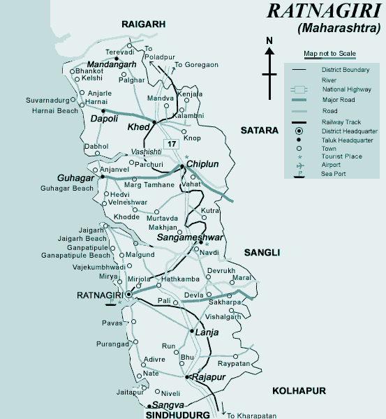
Geographical Information
Ratnagiri can be physically divided into 3 zones.
Coastal Zone – This zone extends to about 10-15 km from seacoast and generally has low altitude and about 2500 mm rainfall. Most of the activities in this area are connected with sea. This area contains numerous beaches, creeks, sea forts, harbors, hot water springs, caves, temples and other religious places, places of scenic beauty as well as birthplace of some great personalities. The possible tourist activities include inland and sea water ways, sailing, boating, water sports like water scooter, canoeing, fishing, camping, marinas, coastal resorts and marine parks; but the major problem is the lack of easy accessibility and road network.
Hill area Zone – This area includes the western slopes of Sahyadri and extends up to about 10-15 km. It generally has medium to high altitude with high rainfall of about 3500 mm. A large area in this zone is covered by forest although it is deteriorating very fast. A substantial drop in temperature is experienced at places exposed to the rising western breeze. This area contains hill forts, ghat roads, forests, wild life, etc. It gives panoramic views at many places. The possible tourist activities include trekking, hiking, forest camps, holiday resorts, bird sanctuaries, wild life safari, etc
Middle Zone – This area lies between the coastal and hill areas and generally has a medium altitude. It is more accessible due to the Bombay-Goa-Highway as well as the Konkan railway. However, it contains very few places of tourist interest, mostly religious places and hot water springs.
Rivers Ratnagiri district has major rivers like Washishi, Jagbudi, Savitri, Baw, Ratnagiri, Mukchundi, Jaitapur etc. They swell in the Sahyadri Mountains and flows to the west and get access to Arabian sea. Since the river basins are shallow, their flow is very speed in the monsoon season. Therefore, these rivers have limited use.
Mountain Range There are upper rows of Sahyadri on the eastern boundary of the district. The height of these mountain peaks is generally 400 to 2000 meters. There are numerous mountain ranges in parallel to each other, entering the Ratnagiri district.
Forest area The total forest area of Ratnagiri district is 7001.67 hector. In this forest, trees like teak, Nilgiri, Khair, Cashew, Mango, Cashew, Fanas, Mother, Dhaman, Shivan, Sugar, Khayar, Jambhul, Chinch and Shivari are found. The district has area of 8208 sq.km out of which the reserve forest area is 48.91%. , the protected forest area is 0.03% and the classified forest area is 23. 88%.
Agriculture Area under cultivation – 2 lakh 75 thousand hectare. Major crops- mango, coconut, jackfruit, betel nut, rice, ragi.
Map of District